
Photographing Acadia in Autumn: A Practical Guide to Coast, Ponds, and Mountain Light
Acadia National Park fits an unusual variety of landscapes into a relatively compact part of Maine. Granite shoreline, spruce forest, quiet ponds, carriage roads, and open mountain ledges can all become part of the same trip. The challenge is not finding something to photograph. It is deciding where to spend your time.
On my visits in October 2018 and October 2019, I had better results when I treated Acadia as a group of distinct photographic areas rather than a checklist of famous viewpoints. I could work one stretch of coast through the changing morning light, use the middle of the day for ponds and wooded roads, and choose one destination for the evening. That slower approach left room to respond to weather, color, and changing conditions instead of spending the day chasing the next stop.
Begin with one coastal area, not three sunrise stops
Acadia's eastern shore is an obvious place to begin a photography day, but the most useful lesson from my visits was to commit to an area rather than a single view. Along Ocean Path, I started roughly half an hour before sunrise in October 2018 and continued well into the morning. When I returned in October 2019, I worked another part of the same broader coast shortly after sunrise. The location kept changing as the sky brightened, direct light reached the trees and granite, and the ocean shifted between broad patterns and smaller gestures.
Before sunrise, the softer light simplified the color palette and let the coast carry the composition. Long exposures smoothed the water and stretched the moving clouds while the fixed granite remained crisp. Later, brighter light brought more separation to the autumn foliage and made smaller shoreline details easier to isolate. Sunrise was a transition, not an ending.
A long exposure turns the sky and water into broad shapes, allowing the granite edge to guide the composition into the distance.
The practical challenge is giving yourself enough time to get into position safely. The Sand Beach parking area serves Sand Beach, Ocean Path, and Great Head Trail, and legal right-lane parking is available on designated portions of the one-way Park Loop Road. Parking and traffic flow can change the timing of a morning quickly, so an alternate starting point is useful.
The official Ocean Path guide describes a route that is about 2.2 miles each way. The section beyond Thunder Hole becomes rockier and more uneven, with roots, granite stairs, and steep drops near the ocean. In low light, sturdy footwear and a reliable light matter as much as the camera equipment. Starting photography half an hour before sunrise means being safely in position and ready by then, not arriving at the parking area at that time.
Framing the beach with nearby evergreens turns the curved shoreline into a natural path toward the headland.
Use Schooner Head when atmosphere matters more than color
Schooner Head gave me a quieter, more restrained coastal study. My October 2018 photographs began just after sunrise and continued for nearly an hour. The early frames held muted color and soft water; as the session progressed, I moved toward a high-key black-and-white interpretation that emphasized the separation between dark rock and pale sea.
This is a good example of letting conditions suggest the treatment. When the sky is plain or the color is subdued, the photograph does not need to force drama that is not there. Shape, tonal contrast, and the spacing between rocks can carry the image. A longer exposure can further simplify the water, but the central decision is compositional: arrange the dark forms so they feel intentional rather than scattered.
The high-key treatment reduces the scene to layered rock, water, and shoreline, with the long exposure quieting the space between them.
Schooner Head is part of the broader Park Loop Road area. The road is partly one-way, and stopping is limited to legal parking areas and designated pull-offs. Review the official Park Loop Road guide and Acadia maps before the morning so the traffic pattern does not become a surprise in the dark.
At Little Hunters Beach, build the frame around moving water
Little Hunters Beach offered a different kind of coastal morning in October 2019. I photographed there from shortly after sunrise into the early morning, concentrating on the relationship between moving water and the fixed rocks. Instead of relying on a broad horizon, I brought the foreground close and used the channels between the rocks to organize the surf.
The shutter speed changes the visual language of a scene like this. My exposures ranged from a fraction of a second to a little more than half a second, enough to show flow without removing all texture from the water. The useful question is not simply whether the water should look soft. It is whether the motion helps reveal the shape and direction of the shoreline.
The water traces several paths through the rocks, giving the foreground movement while the headland stabilizes the frame.
Coastal conditions can change quickly. Wet rock and seaweed are slippery, and rising water can remove a safe route more quickly than expected. The National Park Service's safety guidance recommends staying alert to surf, tides, footing, and rapidly changing weather. Work from durable surfaces, keep a conservative distance from the water, and never let the tripod position become more important than a safe retreat.
Let ponds and carriage roads carry the middle of the day
The inland landscapes changed the pace of my October 2018 trip. Around Jordan Pond, the Bubbles, and nearby carriage roads, the photographic opportunities were less dependent on one brief moment of light. Open water created reflections and separation; the wooded roads offered color, repetition, and strong leading lines; granite and autumn foliage supplied structure even after the warmest light had passed.
At Jordan Pond, a wide view worked because the shoreline rocks made a solid foreground and the Bubbles provided a clear destination across the water. The morning light separated the left shoreline from the darker mountain slopes, while the open sky kept the composition from becoming visually crowded. This is a landscape where foreground placement matters: a small shift can either connect the rocks into a useful base or leave them feeling like unrelated clutter.
The foreground stones give the open view weight, while the two rounded peaks provide a simple visual destination across the pond.
The road and repeating granite blocks provide a strong framework for the dense autumn color.
On the carriage roads, the problem is almost the opposite. Woodland color can become chaotic when every bright leaf competes for attention. I look for a strong path, a line of coping stones, a wall, or a tunnel of trees that gives the color an underlying structure. Once that structure is clear, the autumn foliage supports the composition instead of becoming the composition.
Acadia’s carriage roads are shared by walkers, cyclists, and horse-drawn carriages. Keep tripods and bags clear of the travel corridor, and expect conditions or seasonal closures to change. The National Park Service provides a carriage-road guide and an official carriage-road map. Jordan Pond can be congested, particularly later in the day, and its shoreline is part of a public drinking-water supply. The official Jordan Pond page explains current access, parking, and use restrictions.
Use Eagle Lake for quieter studies of autumn color
Eagle Lake offered a more intimate photographic experience during my October 2019 visit. I was there in midafternoon beneath soft, overcast light rather than during golden hour. Those conditions worked well for the shoreline because the subdued contrast preserved detail in the evergreens, reeds, colorful trees, and their reflections.
The broader view depended on layers. Grasses and partly submerged rocks established the foreground, a narrow point of trees carried the eye into the frame, and the autumn-covered hillside completed the background. Without dramatic light, the composition needed that clear progression from near to far.
Reeds and rocks establish a quiet foreground while the tree-covered point carries the eye toward the colorful hillside across the lake.
A tighter frame uses the dark forest to contain the brighter foliage, while the reflection extends the color into the foreground.
A tighter composition produced a different kind of photograph. By excluding most of the sky and surrounding landscape, I could concentrate on the strongest red, orange, and yellow trees and their reflections. The dark evergreens acted as a visual frame, helping the brighter color remain organized rather than becoming a wall of competing detail.
Eagle Lake is connected to Acadia’s carriage-road network, making it useful for both photography and a longer walk. The carriage road loops around the lake, with some sections involving hills and extended distances. Parking near the Route 233 access can be congested, so have an alternate plan if the area is full. Consult the National Park Service’s carriage-road access guidance and official maps before setting out.
At Bubbles Divide, use open granite to create depth
The Bubbles Divide area brought together several of the features that make inland Acadia photographically interesting: exposed granite, autumn-covered slopes, scattered evergreens, and elevated views toward the surrounding water and mountains. I photographed there during the afternoon in October 2018, when directional light brought out the texture of the granite and separated the warmer foliage from the darker forest.
On the approach, the challenge was arranging a landscape with many competing elements. The broad granite ledges gave me a strong solution. Their cracks and weathered lines created a foreground path toward the trees and distant opening, while patches of red vegetation connected the rock to the larger sweep of autumn color.
Near Balance Rock, including a person changed the scale of the scene. The figure provides an immediate comparison for the large glacial boulder and keeps the surrounding valley from feeling abstract. Small pools and lines in the granite lead toward the person, while the lake, foliage, and mountains create successive layers behind him.
Strong foreground texture and a sweep of autumn color give the eye a path through the landscape toward the distant opening.
The hiker reveals the scale of the glacial boulder, while the open ledge creates a series of layers extending into the autumn landscape.
The Bubbles hike includes forested paths, stone steps, steep rocky sections, and exposed granite that can become slick in wet weather. The National Park Service’s official Bubbles hiking guide describes the route, terrain, and current access considerations. Carry water, extra layers, and a park map, wear shoes with dependable traction, and allow enough time to return before the light fades.
Look beyond the park boundary for a quieter midday stop
Little Long Pond gave me a calm midday alternative to the busier park destinations. In October 2018, heavy clouds lowered the contrast while still allowing the orange trees and their reflections to stand apart from the dark water. The pond's clean edge and open surface made it possible to build a simple layered composition without needing dramatic light.
The reflection doubles the autumn color, while the dark sky and water keep the bright trees from overwhelming the frame.
Little Long Pond is managed by the Land & Garden Preserve, not the National Park Service. Its natural lands include hiking trails and carriage roads, and its rules differ from those inside Acadia. Check the Preserve's Little Long Pond information and trail map before visiting; the trails and carriage roads are open from dawn to dusk, and bicycles are not permitted.
Choose one late-day destination and stay with it
Late in the day, travel time becomes a photographic decision. Acadia's roads, parking, and walking distances can turn a short map distance into a rushed setup. I would rather arrive early at one promising area than spend the best light moving between several famous views.
Cadillac Mountain rewards that preparation. In October 2018, I photographed the summit shortly after sunrise, using other visitors on the granite ledges to give the open view scale and a human point of connection. On the following evening, I worked around Blue Hill Overlook roughly half an hour before sunset. Arriving with time to spare meant I could watch the light change instead of treating sunset as a single instant.
The small figures give the broad coastal view scale and turn the sunrise into a story about experiencing the landscape.
Vehicle reservations are required seasonally for Cadillac Summit Road and are separate from the park entrance pass. A reservation provides a road-entry time, not a guaranteed individual parking space. Conditions at the summit can also be colder, windier, and foggier than lower parts of Mount Desert Island. Review the official Cadillac Mountain informationbefore committing to the drive, arrive well ahead of the light you want, and stay on designated surfaces around restoration areas.
Give Schoodic Peninsula its own evening
Schoodic Peninsula was my strongest late-day coastal experience in October 2018. I photographed there through the afternoon and continued until the sun was nearly down. The open granite, tide pools, and low western light provided a very different foreground from the eastern shore of Mount Desert Island.
The scene became more interesting as the sun dropped beneath the cloud layer. Dark pools echoed the sky while the rough granite held enough texture to keep the lower half of the frame active. At that point, the sun itself was only one small element; the larger photograph depended on the balance between the bright horizon and the dark, reflective foreground.
The tide pools repeat the dark sky and give the small burst of sunlight a second point of emphasis in the foreground.
Schoodic is the mainland portion of Acadia and is about an hour by car from Hulls Cove. Its loop road is largely one-way, and visitors must use designated turnouts rather than stop in the roadway. The granite around Schoodic Point is uneven and can be hazardous when wet or when waves are high. The official Schoodic Peninsula guide covers current access, vehicle restrictions, transportation, and safety considerations.
The important planning point is separation. Schoodic deserves its own outing. Pairing it with a tightly scheduled Mount Desert Island sunset leaves too little margin for traffic, scouting, and changing weather.
Photograph Bass Harbor Head Light before the sunset rush
I visited Bass Harbor Head Light in the afternoon, more than two hours before sunset. That timing gave the lighthouse and cliff warm directional light without making the session depend on the final minutes of the day. It also encouraged a composition based on the relationship between the white structure, glowing granite, dark foreground rock, and deep blue sky.
Warm afternoon light separates the lighthouse and cliff from the shaded rocks, creating depth without relying on sunset color.
Bass Harbor Head Light has a small parking lot, and roadside parking is prohibited on the entrance road and Route 102A. The cliff viewpoint requires a gravel path, wooden stairs, stone steps, and careful footing on coastal terrain; an accessible overlook is also available near the parking area. Sunset congestion can be severe. The official visitor guide explains parking, vehicle limitations, and viewpoint access.
A practical rhythm for an Acadia photography day
The goal is not to force every day into the same itinerary. Weather, foliage, parking, and road conditions will change the plan. Still, the following rhythm worked well during my autumn visits:
Choose one coastal area for the morning and be in position before the light you want begins.
Treat sunrise and sunset tables as planning references, then respond to what the terrain, clouds, and water are doing.
Use the middle of the day for ponds, carriage roads, woodland details, scouting, and travel.
Choose one late-day destination and arrive early enough to study the foreground before the light changes.
Keep an alternate area in mind when parking is full or conditions do not support the photograph you expected.
Acadia requires patience more than speed. Allow time for one-way roads, parking, walking, and safe setup. Carry layers, dependable footwear, a light for predawn or dusk, and a map that does not depend entirely on mobile service. Stay on durable or designated surfaces, follow posted rules, and practice Leave No Trace principles so that the landscape remains healthy and accessible.
Access, entrance passes, vehicle reservations, road closures, parking rules, hours, and regulations can change. Before visiting, check Acadia's current conditions, fees and passes, and official maps. Then give yourself enough room in the schedule to let the place, rather than the clock, shape the photographs.
Contact Scott to commission a print or license for any images in this article.
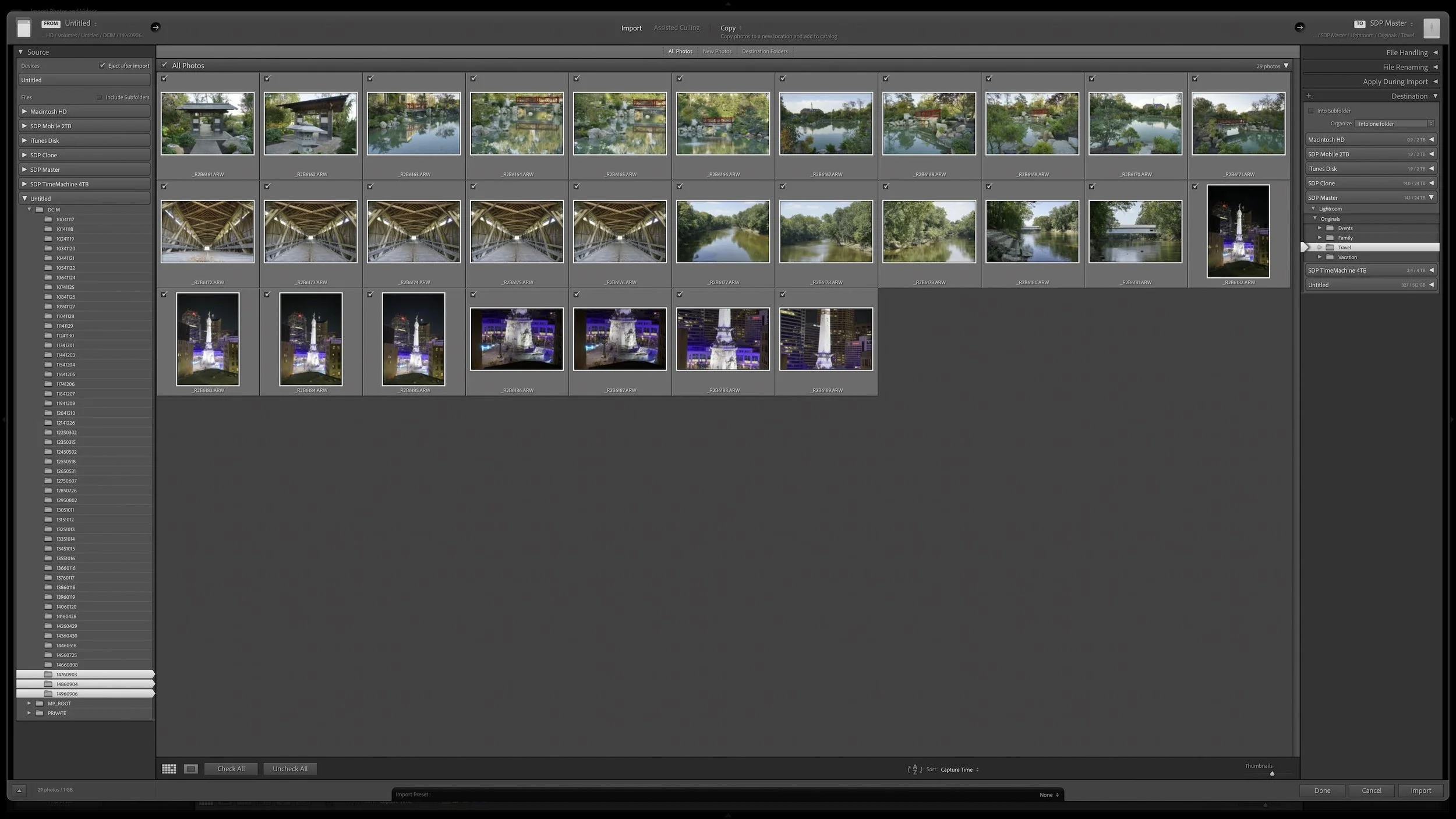
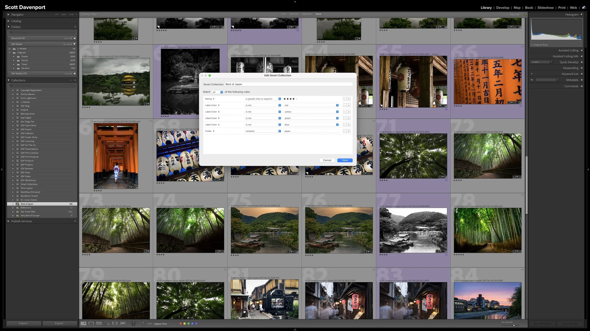


Lightroom Classic's Import dialog asks many of the same questions every time you bring in photos. Rather than rebuilding those settings for every import, you can save the choices that stay consistent in an import preset.
The preset doesn't eliminate the decisions that change from shoot to shoot. It gives you a reliable starting point, so you can concentrate on the source, destination, and other details that actually need your attention.