
California’s Eastern Sierra is a landscape of contrasts. High desert opens toward abrupt granite peaks, lakes mirror the mountains, and weather can move a scene from autumn into winter in a matter of hours. That variety is what makes the region so productive for photography—and what makes preparation important.
I visited in October 2025, when autumn color remained in the valleys and fresh snow covered the higher country. These six areas offered very different ways to work: broad mountain studies, intimate shoreline compositions, historic details, and tufa formations that changed character as daylight faded. Rather than treating them as a checklist, think of each as a different photographic problem to solve.
Long Valley and Benton Crossing Road: Let the Mountain Wall Set the Scale
The open country east of Mammoth Lakes gives you distance from the Sierra crest. That distance is valuable. Instead of looking steeply upward from the base of the mountains, you can study the whole relationship among desert foreground, foothills, and snow-covered peaks.
At sunrise, I watched cool blue shadows give way to warmer light on the high ridges. A moderate telephoto view isolated the folds and diagonal lines in the peaks, while a longer lens compressed the mountain layers and simplified the frame. The important choice here is not simply focal length. It is deciding whether the foreground should provide a path into the landscape or whether the mountains themselves should fill the photograph.
The creek creates a quiet visual path toward the peaks while warm dawn color separates the mountains from the cool foreground.
Strong converging lines give this broad landscape a clear destination, while fresh snow reduces the scene to a restrained blue-and-white palette.
On this visit, I began working around sunrise and continued as direct light reached more of the range. If you want that transition, allow time for driving, finding a legal pullout, walking, and setting up before the sun appears. Benton Crossing Road is an active public road: photograph only from a safe, legal place completely clear of traffic, never from a travel lane. Conditions can change quickly after a storm, so check Mono County road conditions and the Caltrans highway report before heading out.
Convict Lake: Use the Shoreline to Organize a Big Landscape
Convict Lake can feel visually overwhelming. The mountain wall is immediate, the shoreline is busy, and reflections can compete with rocks, trees, and sky. The shoreline solves that problem when you use it as structure. Rocks can establish a foreground rhythm, branches can frame the upper edge, and a clean reflection can connect the lake to the peaks.
Fresh snow and remaining autumn leaves gave me two distinct approaches in October. In the brighter morning photographs, the color contrast between yellow foliage and blue-white snow carried the scene. At sunrise on the following morning, the light was quieter. I made the reflection photograph about five minutes after sunrise, when warm light had only begun to touch the highest ridge. The restraint is the point: most of the frame stays cool, so the small area of warm light matters more.
A bright edge of foliage encloses the cooler reflection, turning the meeting of autumn and winter into the organizing idea.
A small band of warm light on the ridge becomes the focal point because the lake and foreground remain in cool morning shadow.
The Inyo National Forest’s Convict Lake trail information describes parking at the trailhead and a route along the north shore; farther into Convict Canyon the route becomes rugged and includes a hazardous stream crossing. A full backcountry hike is not necessary for strong lake photographs. Give other visitors room, use established paths and durable surfaces, and check the Inyo National Forest alerts for current closures, fire restrictions, and site conditions.
June Lake Loop and Grant Lake: Simplify Stormy Weather
Grant Lake showed a different side of the region. Snow covered the open slopes and shoreline, low cloud erased part of the mountain detail, and dark water divided the mostly white landscape. Those conditions rewarded simplification rather than a search for grand light.
I used the curving shoreline as the dominant shape and let a small structure provide scale. When clouds hide the peaks, the absence of detail can help. It removes visual competition and shifts attention toward graphic relationships: the curve of land, the dark lake, and the repeating marks of snow.
The lake’s dark curve and a small lakeside structure give order and scale to a landscape softened by snow and cloud.
Grant Lake is part of the June Lake Loop, where access and services vary with the season. Portions of the loop may close in winter, so consult current county and highway conditions rather than assuming the entire circuit is open. The official Mono County visitor page for Grant Lake provides an overview of the lake and its developed recreation, while the Inyo National Forest is the place to confirm current public-land alerts and restrictions.
Lundy Lake and the Bridgeport Area: Work With the Seasonal Overlap
Lundy Lake brought the trip’s autumn-and-winter overlap into one frame: orange foliage at lake level, fresh snow on the slopes, and bright sun breaking through fast-moving cloud. The wide view worked because each layer had a distinct role. The near vegetation anchored the foreground, the lake opened the middle of the composition, and the canyon walls carried the eye into the distance.
Autumn color and new snow create warm-cool contrast across the frame, while the lake leads the eye deeper into the canyon.
Elsewhere near Bridgeport, a longer view across bands of cottonwood and brush simplified the scene into layers of color beneath a cloud-wrapped peak. That is a useful alternative when the sky and mountains will not fully clear: build the photograph around repeating horizontal bands and allow the weather to conceal part of the landscape.
Layered fall color provides structure across the valley while cloud softens the mountain and keeps the scene from becoming too literal.
Mountain weather can make roads, shoulders, and trails slick or impassable. Park only in established or clearly legal areas, avoid trampling shoreline vegetation, and turn around when conditions exceed your equipment or experience. Before traveling, review Mono County’s road and winter resources and the current forest alerts.
Mono Lake: Stay Through the Change From Golden Hour to Twilight
The tufa at Mono Lake become more than unusual formations when you pay attention to separation, scale, and the waterline. A wider composition can show the towers as part of the basin; a longer view can isolate repeating forms and compress them against distant mountains. Calm water adds another layer through reflection, but a clean silhouette can be just as effective when the surface is restless.
During my October visit, late golden-hour light warmed the tufa while the lake stayed comparatively cool. On another evening, I continued through sunset into civil twilight. A 25-second exposure made several minutes after sunset smoothed the water and simplified the background, allowing the nearest tower to carry the frame. The useful lesson is to keep working after the direct light leaves. The color becomes quieter, but the shapes often become easier to read.
Low-angle light reveals the tufa’s rough surfaces, while open water separates the formations from the distant basin.
After sunset, softened water and a restrained blue-and-pink palette give the solitary formation more visual weight.
California State Parks recommends South Tufa when time is limited and describes a one-mile self-guided nature trail. The reserve protects a fragile ecosystem: stay on designated routes, never climb or damage tufa, and observe current wildlife rules. Access roads may be unplowed in winter, and restrictions can change. Confirm park hours, road conditions, fees, closures, and regulations before visiting. Drones are prohibited over Mono Lake and state-managed shoreline except by special-use permit.
Bodie State Historic Park: Build Stories From Details
Bodie asks for a different kind of attention. The broad view establishes the high-desert setting, but the smaller scenes carry much of the photographic story: a worn chair and hat, a music room, a classroom, or an old truck surrounded by grass. These subjects work because the objects have clear relationships to one another, not simply because they are old.
Midday light can be useful here. Outdoors, passing cloud adds texture to the sky and reduces the severity of hard light. For interiors and sheltered objects, look for side light that separates an object from a dark background. Keep the frame disciplined. A doorway, wall edge, or arrangement of furniture can provide structure without explaining every part of the room.

The truck anchors the foreground while its curves and color contrast with the angular buildings and open high-desert landscape.
Looking through the historic buildings in Bodie encouraged me to slow down and pay attention to smaller scenes as well as the town itself.
Bodie State Historic Park preserves the town in a state of arrested decay. Its hours vary by season, closure times are enforced, and the usual approach includes an unpaved section that can become difficult after rain or snow. Review the park’s official access guidance and current SR 270 conditions before making the drive. Historic objects, plants, rocks, and other resources must remain where they are; commercial photography requires advance permission.
Plan for the Light, Then Respond to the Weather
The Eastern Sierra rewards a plan, but it rarely follows one perfectly. Sunrise may begin with clear light and end in cloud. Autumn color may sit beneath fresh snow. A broad mountain view may disappear and leave a more graphic shoreline or woodland composition in its place.
The goal is not to force every destination into the same style. Give yourself enough time to arrive, walk, orient the frame, and set up before the light you want. Then pay attention to what the weather is simplifying, revealing, or changing. Before every visit, verify current access, permits, closures, park hours, road conditions, weather, fire restrictions, and local regulations with the responsible land manager. Follow Leave No Trace principles and use established routes and durable surfaces so these places remain enjoyable for photographers and everyone else.
Contact Scott to commission a print or license for any images in this article.

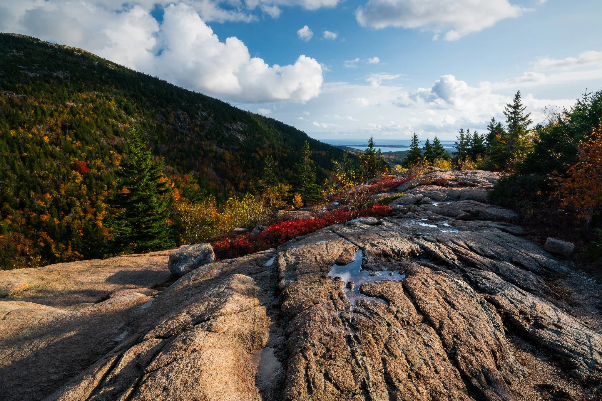

California’s Eastern Sierra brings together high desert, alpine lakes, historic places, and one of the most dramatic mountain walls in the West. In October 2025, fresh snow arrived while autumn color still held in the lower country, creating a useful study in how weather and changing light can reshape familiar landscapes.
This guide looks at six broader areas—from Mono Lake and Bodie to Convict Lake and the June Lake Loop—and the photographic ideas each one invites. The emphasis is on timing, composition, safe access, and staying flexible when mountain weather changes the plan.